Reaching for the Skies with Drone Technology
As part of work on the Proptech Innovation Network (PIN) we have opportunities to work collaboratively within the housing sector to solve collective issues using the latest technology. Recently we have been working with Netherlands-based company, Spotr, to see if we can apply Drone Technology and Artificial Intelligence to some of our properties so we can better understand them, spot anomalies, and take out the hard and costly approach to working at heights.
I was fortunate enough to meet up with Niels and Dylan of the Spotr team on one of their recent visits to the UK. Lucky for me they brought some of their expensive kit with them too! We decided that Barkla Fields (our independent living scheme in Widnes) would be a great one to view from the skies. This would give us a chance to see the layout of the building from above and spot any potential areas for repair or revisits in future.
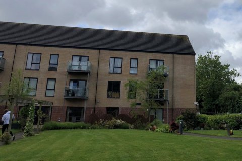
The Drone over Barkla Fields
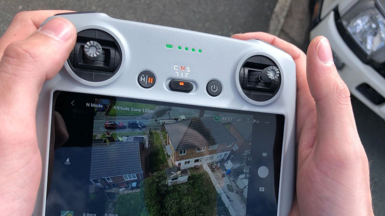
I met the guys at 8am at Barkla. Weather conditions were great for a flight, so they wasted no time in getting their drone up in the air. Residents of Barkla fields (who were informed in advance) looked on in amazement as the flying eye circled the building. The technology used in these drones has advanced so much in the last few years. It stabilises itself in mid-air and battles against the wind. As Niels told me “Very little certification is required as all we need to do is tell it where to go and press the camera shutter,” they even land themselves safely!
The whole building took around 90 minutes to circumnavigate, and with the help of Dylan’s mounted SLR camera taking hundreds of external images, we now had plenty of data for Spotr’s AI to fill in the gaps and create a 3D view of the entire structure. All before 10am!

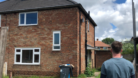
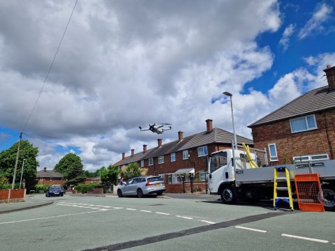
Next up we needed to find one of our standard properties to capture. Our fantastic Voids team provided us with an address in Runcorn that we could try, so following a trip over the bridge (and a £4 toll cost to our Spotr friends) we pulled up to the house and found it would be a perfect fit.
As the house was a lot smaller than Barkla, we were able to capture the whole building in 10 minutes. The drone was only in the air for 6 minutes and was able to do the whole building in 3 laps. We even got a crowd for the survey, as some nearby scaffolders thought there was a swarm of angry wasps on the loose!
Why are we looking at drones?
Overall, this was a fantastic use of modern technology, as we were able to survey at heights without a single piece of scaffold! Spotr’s Artificial Intelligence will now use the data we collated to map the buildings in 3D, and see if any potential repairs need picking up based on what condition our materials are in. In future we could even acquire our own drone for a cheap cost and utilise this for inspections at height (among many other uses).
I will be sharing the 3D models on our innovation page of the website when we get them from Spotr, but when it comes to drone technology and its usefulness in our innovation work, the sky is truly the limit!
The experience was exhilarating and too good not to share! Keep following our innovation work to see where drone technology can take us.

Anthony Atherton
Ant is Innovation Analyst working in our award-winning innovation team. He works on a variety of projects that challenge new ways of managing our homes, assessing new technologies and ways of working, particularly in the area of compliance and sustainability.


